
Calgary: Urban Development Time Travel
Editor’s Note: This is the second guest blog by Jeff Trost. The first was of his experience Augusta National Golf Course for a Master’s practice round in 2017. This blog is a fun look at Calgary past and present from the air.
I have an addiction… I absolutely love aerial photos. It started when I was young, sitting in the backseat of my parent’s car, passing time just going over pages and pages of the city map books they had. When Google introduced their ‘maps’ function that included satellite imagery, I was hooked. I was familiar with the maps and layouts of the city, but the satellite imagery added so much more context to the scale of things. Road maps gave you only so much information on the things like the types of roads, developed areas etc. But when you switch over to aerial photos, you get to see the full footprint of roads – how many lanes there are, the footprint of a building on a piece of property… all sorts of gems.
What’s even more fun is to see how the aerial photos show the changes and development that occurs over time. Google Earth has a great time lapse/timeline feature that allows you to see different eras. The problem – it’s not always up to date, and because Google draws on so many sources of photos, they don’t always layer or stitch together properly and the resolution is sometimes questionable. There had to be something out there better than Google.
Enter… the City of Calgary online imagery database tool. I think I stumbled across it when looking for some maps or diagrams of the SW Calgary Ring Road, or Crowchild Trail improvements.
What’s so unique about this site is:
The photos are incredibly high resolution and perfectly aligned
There are photos dating back to 1924
You can overlay different eras of photos and drag a slider to see how an area has changed or developed.
Want to see what was on the piece of land your house is on, in 1948? Ever wondered how much Chinook Mall has expanded since 1979? You can do it! Here’s how:
Navigate to www.maps.calgary.ca/CalgaryImagery
On the hand top corner, click the little stack of pages to select the orthophoto by year. I usually leave 2019 selected, and then select another year (for instance here – 1995).

3. Click the two squares with arrows pointing outwards. A small menu will drop down asking the layer you want to swipe – leave it showing the newest year. You’ll now have a split screen, with a line and a little slider down the middle.

4. Go explore! Drag the slider left and right to change the overlay maps and it will adjust in realtime. Click, drag, zoom in/zoom out… Have fun.
My favorite finds:
Some areas you won’t see much change, but other ones are incredible. Because I’ve spent so many hours playing with this tool, I’ve found some interesting gems that I’ll share with you. I’ve included a mix of images where I show the 50/50 slider between the eras, and others you have to see the full change for the area at the same resolution and crop:
Glenmore Trail between 14st & McLeod Trail 2019/1995
You might have forgotten how many homes were removed to expand Glenmore and the Elbow Drive project and how the footprint of the road has changed. This image splits the old & new down the middle:

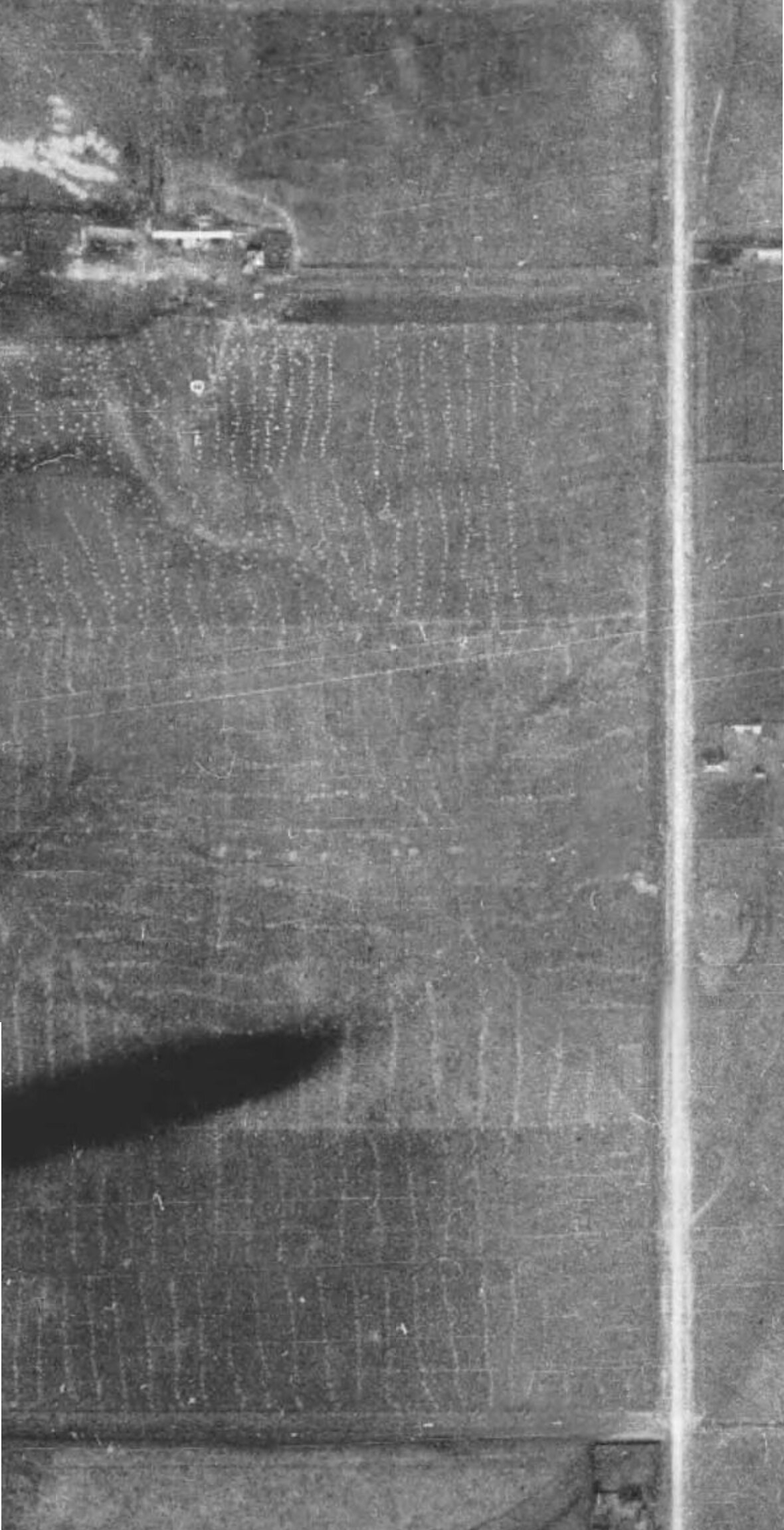
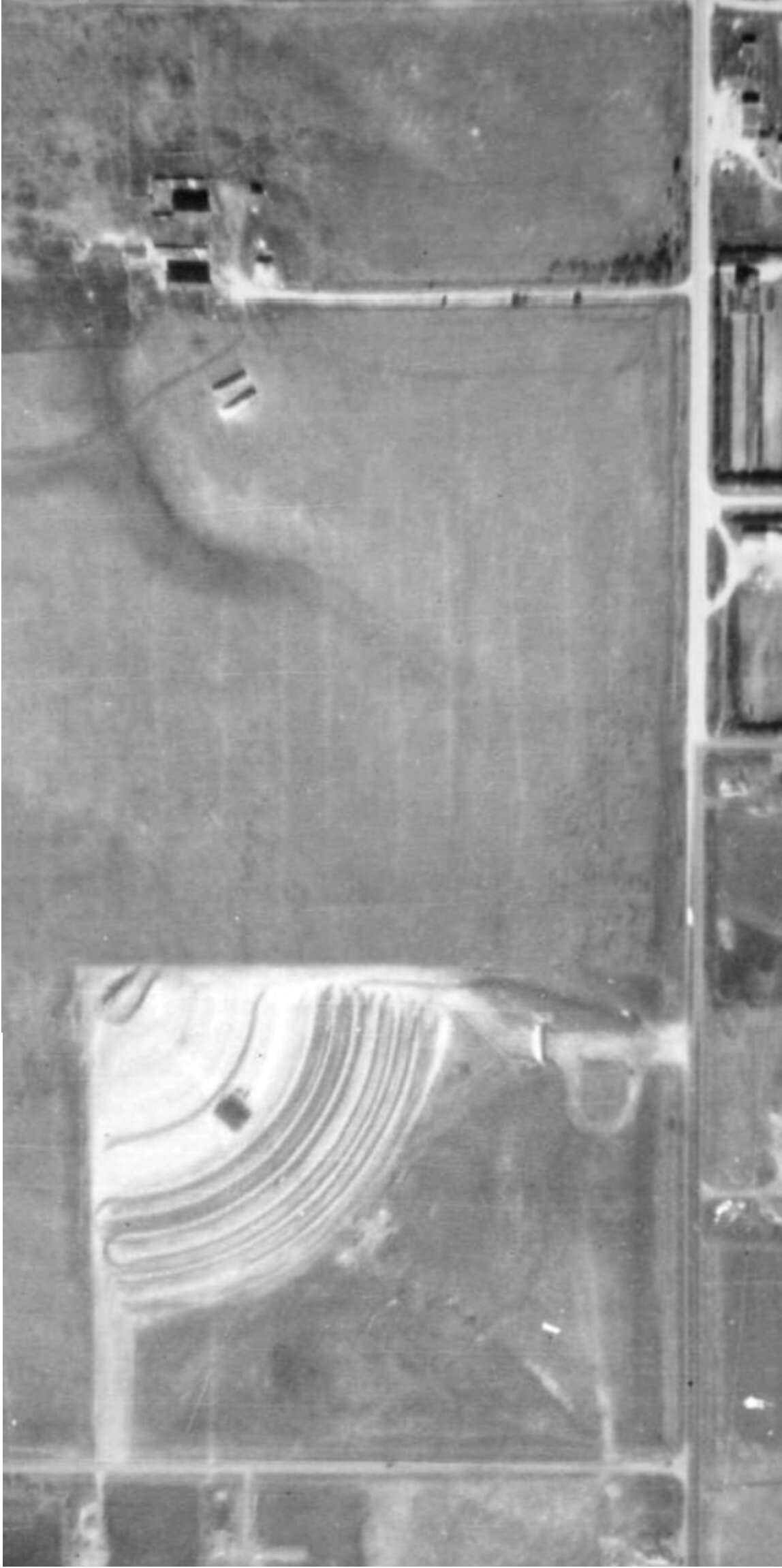
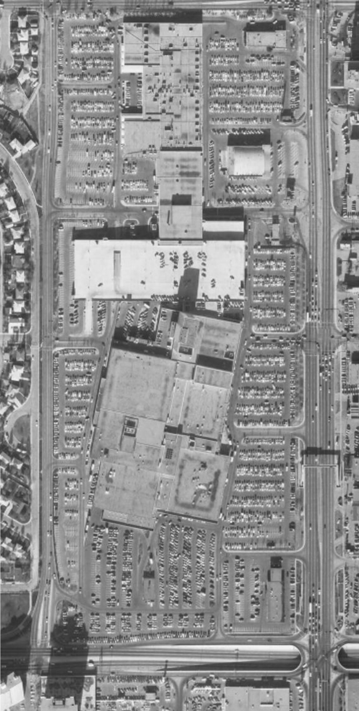
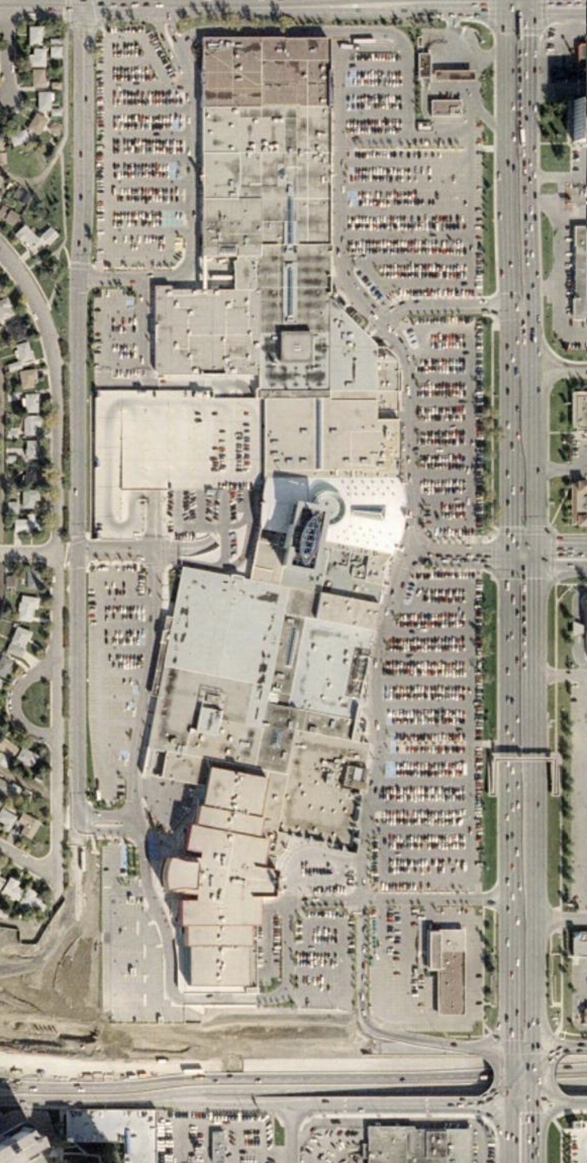
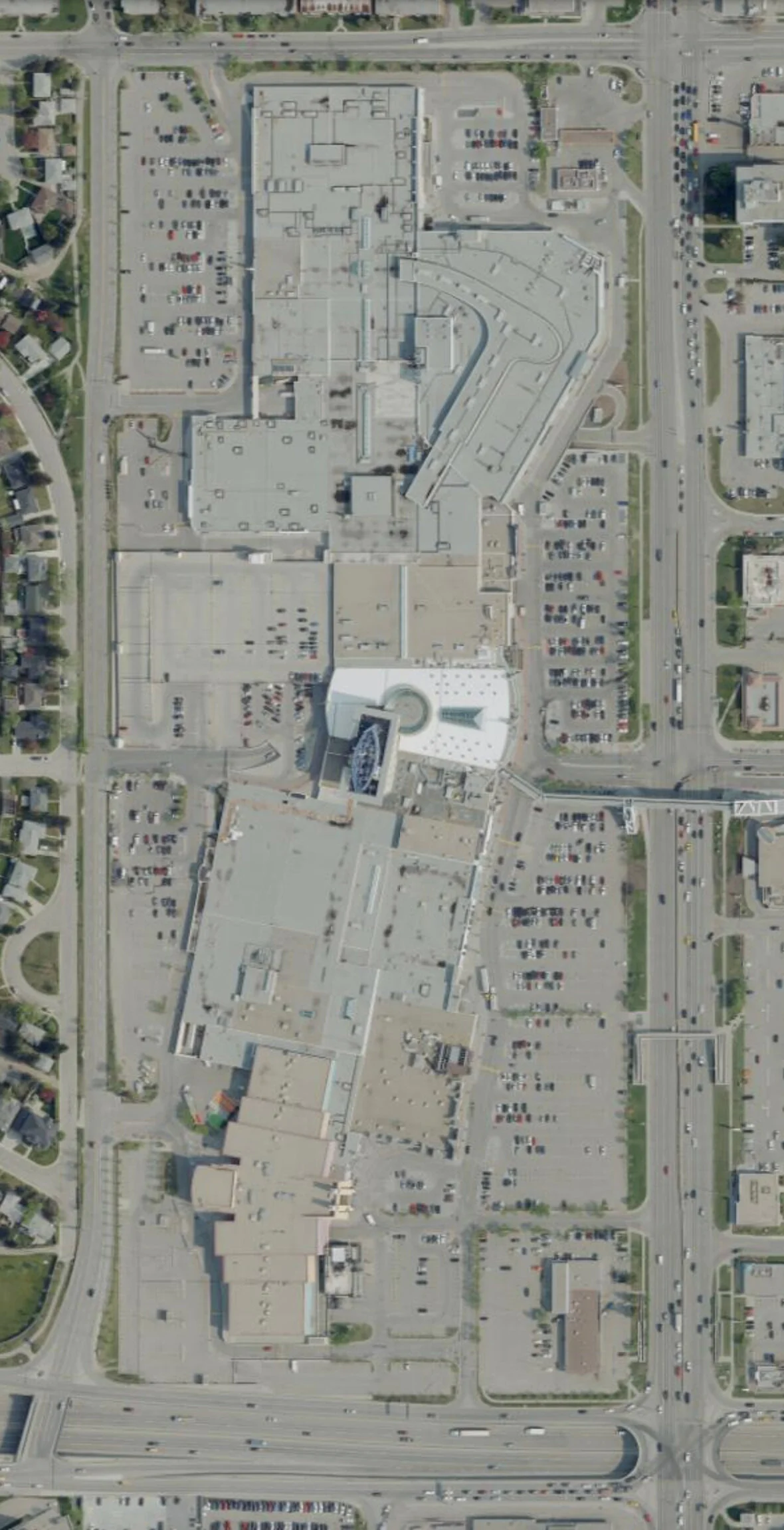
Chinook Centre – 1924/1948/1979/2005/2019
This is very unique to see how the land Chinook Centre is built on has evolved over 96 years. From being just a homestead and on a dirt road, to the home of a drive-in theatre, and then finally seeing the evolution of the mall in the 70s, to the ‘filling out’ with the addition of the theatres at the south end, and finally the 2010s expansion at the north east corner. Other changes you can see when looking close are the addition of parkades, even skylights on certain sections of the mall, and the roads around it - Glenmore Trail interchanges, McLeod Trail, etc.
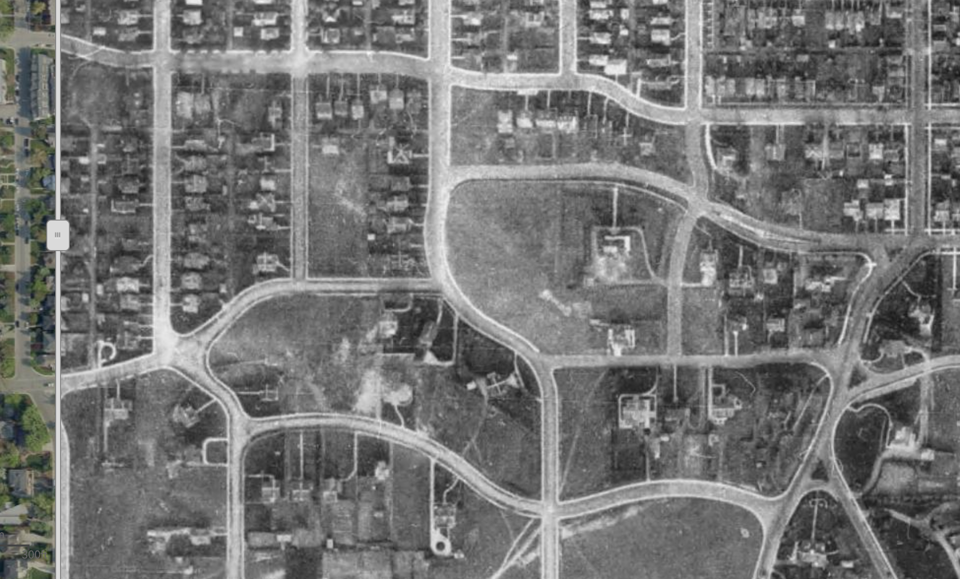
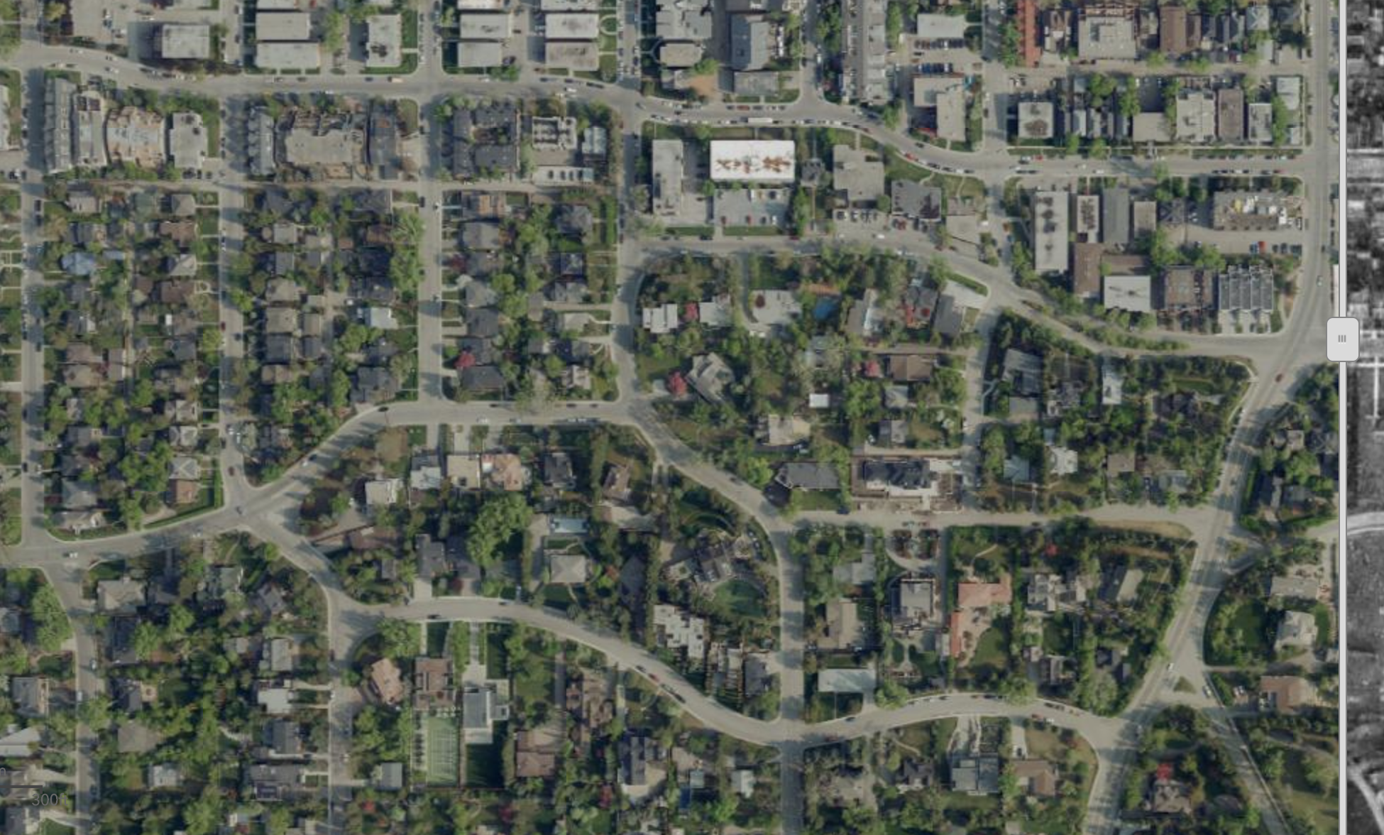
Canada Olympic Park/Winsport & Cougar Ridge – 2019/1979
There was a ski hill but not much to show that Calgary would be hosting the Olympics in 9 years! Houses didn’t come along until early 2000s.

Eau Claire 2019/1924
This split view is worth playing with the slider on the site. Center Street Bridge existed in 1924, but no Memorial Drive. In fact, look how the alignment of 2019 Memorial Drive goes right into the river’s path in 1924. We can see how Prince’s Island was a ‘working’ island as an extension of the sawmill & industrial space where Eau Claire Market now stands. This continued to the west, where we can see in 2019 is now home to high end condos.

Stoney Trail & Crowfoot 2019/1979
Nose Hill Drive was the edge of the city in 1979. Crowfoot didn’t exist. Go further west now and you hit where Stoney Trail now weaves in and out of the image split. Crowchild Trail wasn’t much more than a two lane undivided road past the edge of civilization, now a 6 lane divided freeway.

Anderson Road / Deerfoot Trail East 2019/1979
There was nothing east of the river where you see Deerfoot Trail disappear at the slider dividing the image. In 2019 you can see part of the loop that forms Quarry Park east of the river in the top part of the frame and and on the right you can see why it was named that!

Crowchild Trail/Bow Trail/Memorial Drive 1948-2019.
Unlike downtown and Eau Claire, the path of the river has stayed more consistent around this part of the city. In the bottom portion of the image we can envision where Crowchild & Bow Trail now converge. Further east, the industrial area that is the source of the debate on the need for cleanup during the CalgaryNext & West Village proposals is still operating. North of the river, Memorial Drive still didn’t exist & Hillhurst was a young community with lots still available.

Stampede Grounds & Victoria Park 1948 – 2019
These images are of identical scale & frame. Did you know the chuckwagon & grandstand used to be in a different location on the Stampede grounds? How about the rail yards where Repsol Center now is?


Mount Royal 1924/2019
Not much has changed in Mount Royal. It was already laid out as early as 1924 and has just grown up. Can you imagine Mount Royal without the canopy of trees?
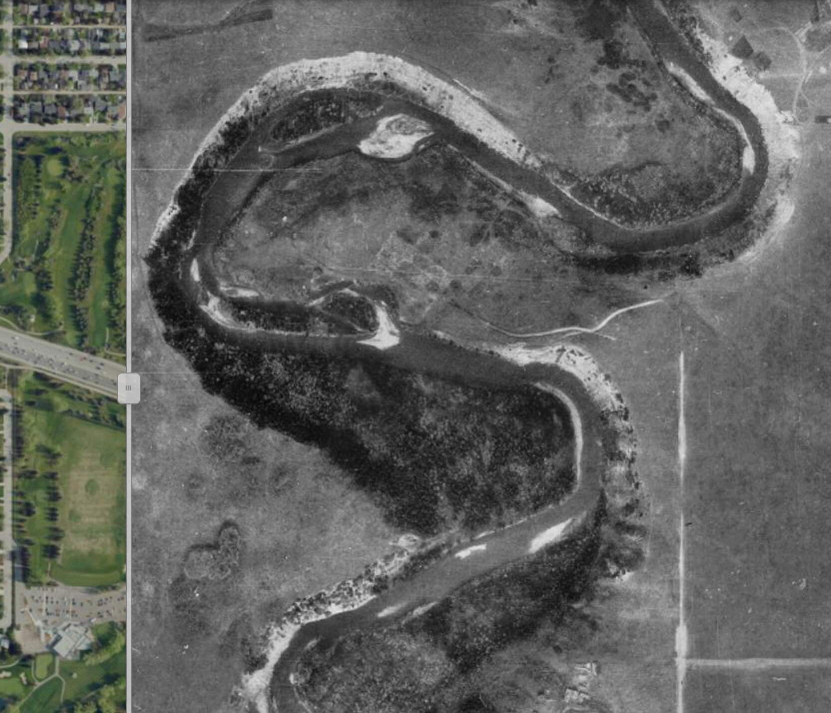
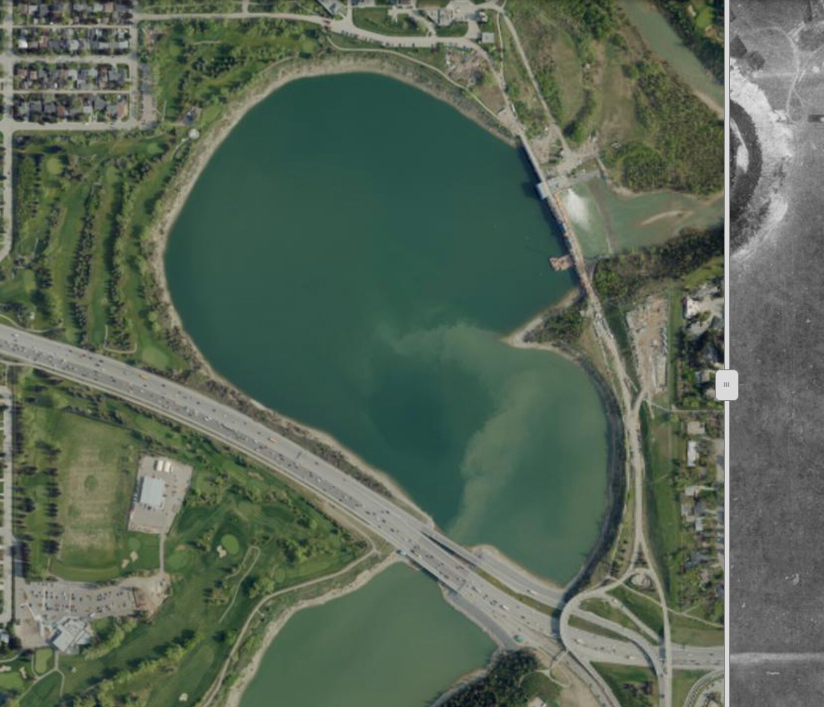
Elbow River 1948/2019
Some places have changed drastically. Look at what the Elbow River looked like in 1948 before the Glenmore dam was built. You won’t sit in rush hour on the causeway looking out to the dam the same again:
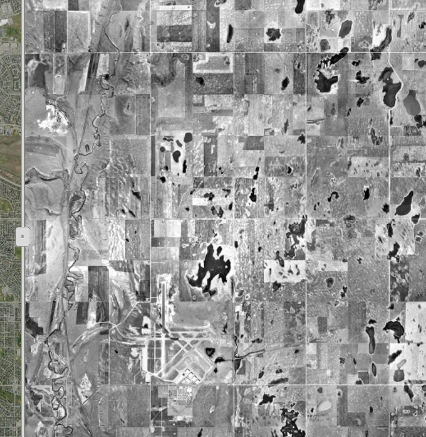
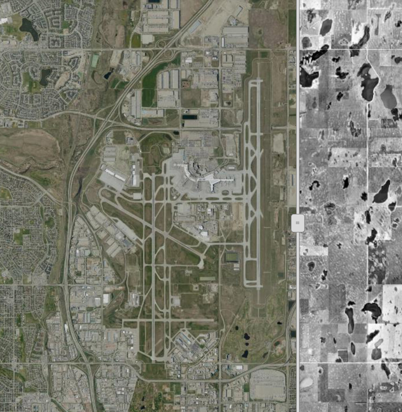
Calgary International Airport 1948/2019
Calgary’s McCall Field airport in 1948 was in the middle of nowhere - no Deerfoot Trail or Airport Trail to get to the airport. The runways were much shorter than what are required today. You can barely see the field in the bottom of the photo under the slough. There are still remnants of the runways and some of the smaller charter air services operate out of this part of the airport today. Is It wrong to post a picture of an airport as we are stuck at home unable to travel?
Final thoughts:
I could have posted hundreds of pictures of interesting finds inside the city limits here, but I leave that to you. It’s a fun tool that the city has provided more likely for historical records and planning purposes, but when we’re stuck at home. it’s a great way to experience our city and perhaps plan your outings to explore some of these areas and try to imagine what they were like.