Eleven Parks That Shaped Calgary's "Sense of Place"
After watching the PBS documentary “Ten Parks that Changed America” I was inspired to identify what parks have changed or I prefer SHAPED Calgary. Some of my choices are obvious, but some might be a bit of a surprise.
FYI: In the blog “Ten Parks that Changed America” I added Chicago’s Millennium Park which wasn’t included in the PBS documentary so I thought it only fair I should pick 11 parks in that have shaped or changed Calgary.
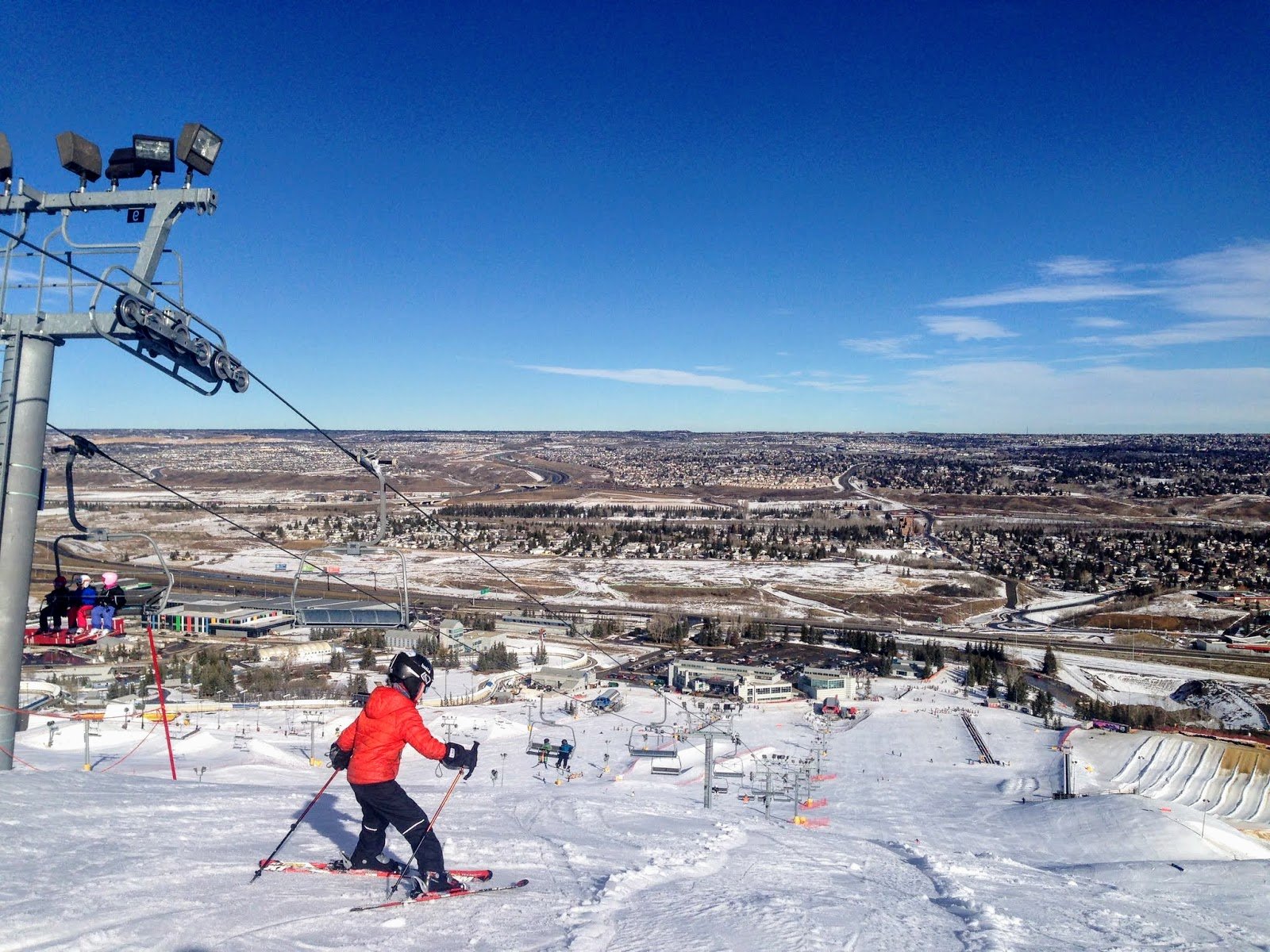
Canada Olympic Park is just one of the 11 parks I think have helped shape Calgary’s sense of place.
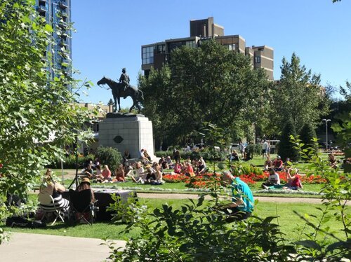
Stampede Park (1889)
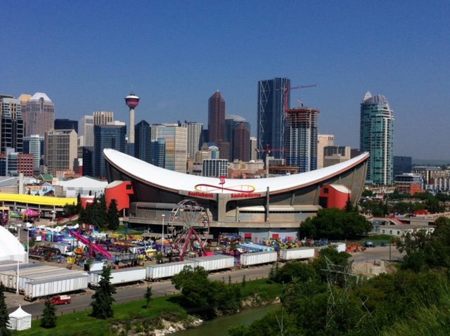
In 1889, the Calgary and District Agricultural Society acquired land on the banks of the Elbow River to host their annual fair that would become Stampede Park. Due to crop failures and declining economy the Society folded in 1895 but was resurrected in 1899 as the Western Pacific Exhibition Company.
In 1908, the Government of Canada announced Calgary would host the Dominion Exhibition, which resulted in the construction of six new pavilions and a racetrack at Stampede Park. The actual Exhibition included a parade, rodeo, horse racing and trick roping and was the catalyst for the creation of an annual exhibition that is today’s Calgary Stampede.
Calgary’s Stampede Park is not only a reminder of our city’s past as a major farming and ranching hub, but how the city has evolved to become a diverse, modern, year-round education and entertainment hub. Collectively the Calgary Saddledome, BMO Centre, Big Four Building, Nutrien Western Event Centre, and TransAlta Performing Arts Studio host 1,200 business, trade, convention, sporting, music, and community events each year.
Stampede Park is managed by 2,000 volunteers who sit on 50+ committees including the 25 individuals on its Board of Directors. Calgary has strong volunteer culture city-wide today in part due to the culture of volunteering in managing Stampede Park.
Link: Stampede Park

FYI: In 1964, the Stampede Board made plans to purchase former military land in southwest Calgary near Glenmore Trail and 24 Street SW. A fully developed plan was released in 1965, and while it had the support of the civic and federal governments, intense opposition from nearby residents (early NIMBYism?) quashed the proposal. Imagine how that would have changed the evolution of Calgary’s City Centre and inner-city southwest communities.


Elbow River Camp is located at Stampede Park along the bank of the Elbow River. First Nation families from the Treaty 7 Nations have been camping at the Park during the Calgary Stampede from the beginning, sharing their culture and stories with locals and visitors.
Bowness Park (1911)
Land for the park (74-acres) was donated to the City of Calgary in 1911 by John Hextall, as part of a deal to secure the extension of streetcar service into Bowness Estates, which he was developing as an exclusive suburb outside the city’s boundaries. The land consisted of two islands in the Bow River, separated from the south bank by a narrow channel, now dammed off to create a lagoon and small canal. Many of the former attractions are gone today: the swimming pool was closed in 1959, dancing ceased in 1960, and the Orthophonic stopped beaming out its music from the middle of the lagoon in 1961.
FYI: The Orthophonic was a phonograph with loudspeakers on three sides that played music for visitors. Park staff would have to row out to flip the 78rpm record over to keep the music playing),
In the 1920s and 30s streetcar service on summer weekends was every 15 minutes. It was estimated on a nice weekend up to 25,000 people would visit the park, with 28 streetcars being assigned to handle the traffic. Streetcar service from Calgary to Bowness was maintained from 1913 through 1950.
Bowness Park is an early example of housing developers building new communities on the edge of the city have shaped the city’s growth for over a century. It is also an example of how developers create parks, golf courses and other amenities to attract home buyers to their new communities. Calgary’s housing developers continue to reshape Calgary with new communities at the edge of the city like SETON, Aspen Woods (new Mount Royal) or Alpine Park.


Memorial Park (1912)
In 1899, William Pearce convinced the Federal Government to donate land that is now Memorial Park. By 1912 the park was complete and considered a civic showcase - the grounds were modelled after a formal Victorian garden featuring geometric pathways, elaborate garden beds, and rows of imported and native trees. It became home to Calgary’s first public library which is still operating today and was the first purposed built library in Alberta.
Memorial Park represents Calgary’s transition from a rowdy frontier town to a cultivated modern city.

Glenmore Reservoir (1932)

Built in 1932, at a cost of $3.8 million, the dam controls the downstream flow of the Elbow River, thus allowing the city to develop property near the river's banks with less risk of flooding. The reservoir created a multi-purpose recreational playground in the middle of the city.
Today the reservoir includes not only a 16-km multi-use pathway/pedestrian and cycling trail along the water’s edge, but also the Heritage Marina beach, Heritage Park Historical Village, South Glenmore Park, Glenmore Sailing Club, Weaselhead Flats Natural Environment Park, North Glenmore Park, Calgary Canoe Club, Calgary Rowing Club, and the Earl Grey Golf Club.
The creation of the dam had a huge influenced on Calgary’s mid-century residential, road and transit construction pushing residential development further south and west. It created the need for Glenmore Trail to not only link 14th St SW and Crowchild Trail as a major north/south roadway, but also to become the major east/west commuter route to get from the residential developments on the west side, to the new industrial, warehouse, developments east of Deerfoot Trail.


River Park (1956)
The land known as River Park, Sandy Beach and the Britannia Slopes was donated in 1956 by Eric Harvie to the citizens of Calgary in perpetuity for the purpose of rest and relaxation. He envisioned a system of foot paths and bicycle paths connecting informal play areas, picnic and lounging areas and lookouts. He distinctly expressed there should be no ornamental flower beds or manicured lawns, no commercial concessions, no billboards and absolutely no vehicular traffic.
What he probably didn’t envision was that River Park would arguably become Calgary’s most popular dog park, with 1,000s of people daily walking their dogs along the kilometer long promenade on the edge of the Elbow River escarpment.
The history of Calgary’s dog parks dates to 1989 when the City of Calgary asked administration to make the city more dog friendly. Today Calgary has 150+ off leash dog parks, which means we have the most dog parks per capita in North America. No new community is complete without its own dog park e.g., East Village, University District, Currie and Greenwich. Even Calgary’s Beltline, a high-rise community has its own dog park.
Lake Bonavista (1968)
In 1968, legendary Calgary home builder E.V. Keith created the 52-acre Lake Bonavista, with a 25-acre park that included a 65-foot waterfall at the edge of the city. It was the first man-made lake community in Canada and the catalyst for several more residential lake developments in southeast Calgary and eventually in the northwest and northeast.
Lake Bonavista was a game changer, unlike Bowness Park which was public, it was the beginning of developers creating private parks, community centres and other amenities to attract Calgarians to move to new communities on the edge of the city. Today Calgary is home to 10+ lake communities.

Lake Bonavista is in the middle of the image with Lake Bonaventure in the foreground. (Photo Credit: Peak Aerials).

Mahogany Lake beach.
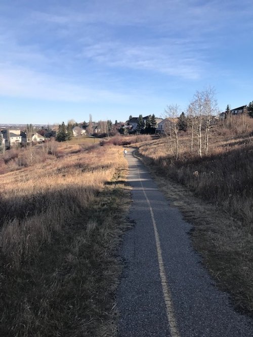
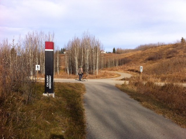
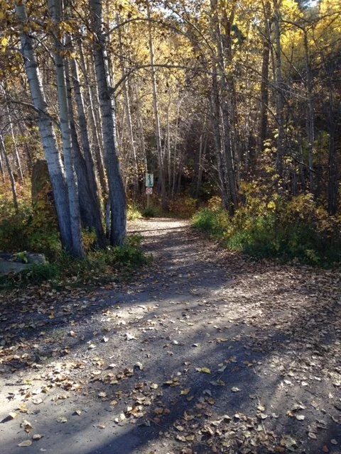
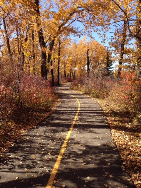
Pathways (1970)
In the late 1960s, Calgarians began envisioning a system of pathways that would connect residential neighbourhoods to the city’s various natural areas, especially along rivers and creeks. The first completed section of the pathway was built through Confederation Park in the early 1970s. Pathways along the Bow River and Elbow River were subsequently added and then throughout the entire city.
Today Calgary boast 1,000+ km of pathways linking all the city’s 200+ neighbourhoods to the city’s 7,000+ parks and green spaces. It includes the Rotary/Mattamy Greenway a 145 multi-user pathway that circles the city linking numerous parks, natural areas, greenspaces, dog parks, river valleys, ravines and 55 communities.
Ironically the Calgary’s first +15 bridge opened in 1970, crossing 4th Ave SW between 2nd and 3rd St SW. Today, the downtown the +15 skywalk is an indoor elevated 16-km pathway that consists of 86 bridges, 15 feet above the sidewalk connecting 100+ office, hotel, retail, and entertainment buildings. The +15 is full of cafes, food halls, shops, public art, and seating areas. It is the Calgary’s equivalent to New York City’s High Line (which was included as one of the “Ten parks that Changed America” PBS documentary).
Perhaps one of Calgary’s biggest differentiators from other cities is its amazing pathways.
Link: Things to do in Caglary: Parks, Pathways & Playgrounds

Nose Hill Park (1980)
In 1971, Hartel Holdings planned to convert the land that is currently Nose Hill Park into a mega residential development. However, a grass roots group from neighbouring residential communities opposed the development which eventually resulted in adopting a plan for the development of Nose Hill Park in 1979 and in 1980 the Nose Hill Park land was officially designated a protected area by the city.
Today the 11-square kilometer park is the fourth largest urban park in Canada. It is enjoyed by thousands of hikers, walkers, cyclists, and dogs every day. It is a prairie grassland oasis in the middle of the city.
The park resulted in the preservation of a major tipi ring and there is evidence of bison kills and other indigenous activities throughout the park. It is a reminder of Calgary’s ancient past.
Like the Glenmore Reservoir, the park forced development around the it, pushing residential development, roads and transit to the northwest and northeast rather than north for several decades.

Nose Hill Park is unique native grassland park in the middle of the city. (Photo Credit: Peak Aerials)
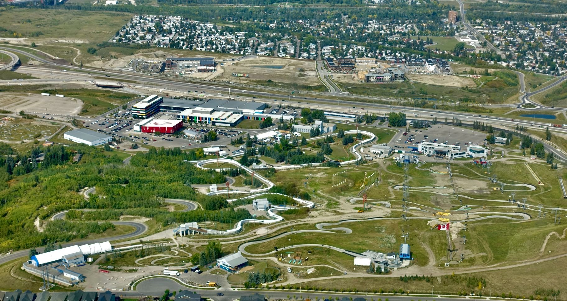
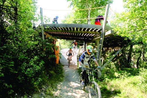
Canada Olympic Park (1988)
Canada Olympic Park (COP) was built to host ski jumping, bobsleigh, and luge events at the 1988 Winter Olympics utilizing the natural terrain of the Paskapoo Slopes. After the Olympics it became Canada’s main training facility for winter Olympic athletes.
In 2008, Canada’s Sports Hall of Fame opened celebrating the accomplishments of 673 athletes and sports champions and housing 1,000s of artifacts. In 2011, four ice rinks were added (one international size ice and three NHL size rinks) that are used not only for hockey, but curling, figure skating, ringette, and power skating. And, in 2014 the Markin-MacPhail Centre opened as a training hub for Canadian athletes.
COP is also home to three zip lines: Monster Line, Plaza Line and Trainer Line, utilizing the Olympic Ski Jump infrastructure. The Monster Line is 500 meters long, with a vertical drop of 100 meters and reaches speeds of 120 kph.
Today (COP) is managed by Canadian Winter Sport Institute (or Winsport Canada) it is a popular hockey, ringette, curling, skiing and snowboarding site in the winter and mountain biking in the summer.
Not only did the 1988 Winter Olympics put Calgary on the map for 10 days, but it helped foster the city’s unique recreation and sports culture.

James Short Park (1991)

James Short Park (Centre Street between 4th and 5th Avenues SW) is one of four parks in downtown Calgary that is in fact a rooftop park as they are built over top of an underground parkade. Other downtown parks built on top of an underground parkade include - McDougall Centre, Harley Hotchkiss Gardens, and the Municipal Building Park.
In 1887, a four room Central School was built on the block with James Short as its first principal. Then in 1905 the new three storey Central Public School was built and operated until 1968. It was demolished to make way for a new Greyhound bus terminal.
The school’s cupola was saved and sat in a city storage yard until 1973 when it was moved to Prince’s Island and then to the new James Short Park in 1991 when the new park opened above a 600+ underground parking garage built as part of the City’s “Cash-in-lieu” parking program (developers building a new office building downtown could only build 50% of the required parking on site and then give the city the cash to build the remaining 50% at another location as a public parkade).
Calgary’s downtown is a much more attractive place to “work, live and visit” because of its four PARKades.
FYI: The copula at the corner of Centre St and 5th Ave SW was restored with the help a substantial donation from the Rotary Club and private funding. The restoration also included the repair and installation of an old clock salvaged from the Burns Building (southwest corner of Centre Street and 8th Avenue) when it was demolished in the 1960s. Hundreds of volunteer hours provided the Calgary Watch and Clock Collectors Association made the clock’s restoration possible.

James Short Park, about the underground parkade.

The Harley Hotchkiss Gardens featuring the Joe Fafard sculpture is built above yet another underground parkade.
Last Word
An honorable mention should go to Heritage Park, a 127-acre park on the banks of the Glenmore Reservoir, home to 100+ exhibits of heritage buildings, a midway from the early 20th Century, Gasoline Alley Museum (antique cars and memorabilia), a steam engine train ride and paddle steamer boat ride, but admittance is by admission only, so it isn’t a public park.
Parks Foundation Calgary founded in 1985 also deserves honourable mention given its role in raising 100s of millions of dollars to help fund 100s of small and larger park projects across the city, including 145 km Rotary/Mattamy Greenway.
Today, no Calgarian is more than a five-minute walk to a park, pathway or green space.
Note: I would like to thank Keith Walker at Peak Aerials who generously allows me to use his images in my blogs. Click on this link to see more of his aerial photography from across Canada and beyond: Peak Aerials