
Chasing Ice, Water and Stone: the Best Routes through Yoho National Park and Kootenay National Park
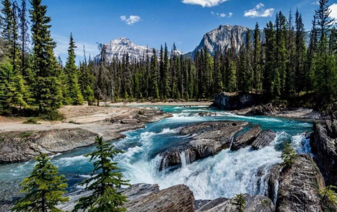
There are mountain parks that will make a beautiful photograph, and there are mountain parks whose character constantly changes every couple of kilometres. Yoho National Park and Kootenay National Park are examples of the latter kind of parks. While one of these parks is characterized by thundering waterfalls, glacial valleys and alpine landscapes not accessible to visitors, the other one transforms from limestone canyons into mineral hot springs and steep sunny climbs. Together, these two parks create one of the best tourism pairs in the Canadian Rockies, especially for hiking enthusiasts who value the experience over achievements.
Many travellers moving between trailheads also spend quiet evenings in Canadian online casinos. That is possible in Canada, but the rules are not the same everywhere. The federal Criminal Code allows provinces to conduct and manage lottery schemes. Provincial authorities then shape their own systems and set player-protection standards. Ontario, for example, runs a regulated internet gaming market through iGaming Ontario under AGCO oversight rather than through one national model. In British Columbia, anyone seeking round-the-clock, free and confidential help with gambling concerns can read the full guide and find support information, useful contacts and clear next steps.
Why Lake O’Hara still feels like the crown jewel
The reason why the trail system around Lake O’Hara maintains itself as high up on the list of conversations about the Rockies as possible is due to the way in which Parks Canada manages this area. Because of how delicate the alpine basin here is, Parks Canada manages the access here via shuttle reservations, meaning that the area does not suffer from being overrun in the same way as many other famous destinations do within the park. The shuttles operate eleven kilometers from the parking lot, walking conditions here are best between July and late September, and the payoff goes beyond just the lake’s beauty.
The most impressive statement path in Yoho is the Iceline. The Iceline at Little Yoho is 20.3 kilometers long in difficult loop form, whereas the Celeste Lake option cuts the distance down to 17.4 kilometers. However, the special thing about this path is not the impressive length but the way the scenery changes throughout the trip. This route starts from the bottom of the Yoho Valley, ascends to the high-level bench offering spectacular glacier views, and then descends through meadow and subalpine terrain that appears like another park.
The Yoho routes that deliver without the long sufferfest
Every notable hike in Yoho isn’t necessarily a grueling journey that takes a whole day. The Takakkaw Falls trail is 0.9 kilometers and not difficult, and yet you will arrive at the bottom of one of Canada’s tallest waterfalls in good time to make this the perfect place to start your visit. Meanwhile, the Emerald Lakeshore Trail measures 5.2 kilometers, and unlike other hikes, it doesn’t rely on height to create awe. Instead, it offers a gentle grade and allows the view to develop through layers as you hike along the lakeshore, surrounded by the forest, glacial water and reflections.
The other secret of Banff is Yoho Valley trail that can be done without being deprived of anything. Valley Bottom trail takes you to Laughing Falls within 4.5 kilometers and further 3.9 kilometers up to Twin Falls. That makes a difference. Laughing Falls is the end of half-day hike, whereas Twin Falls makes the same route much more interesting and committing. River flows nearby, walls come closer and go away, and hiking itself becomes not an attempt to get one single beautiful picture, but movement through the scenery formed under the influence of river.
The most unique thing in Yoho is neither lake nor mountain. It is an organized fossil hike through the Burgess Shale beds. Parks Canada manages the hikes uniquely since they are protected and of global significance, and that makes them unique in the first place.
Kootenay National Park changes the rhythm completely
While the Yoho National Park often ascends right into spectacular alpine views, the Kootenay National Park takes up more space and offers contrasts to visitors. As the Parks Canada states, it is “the place where ice meets fire”, which is quite true in this case.
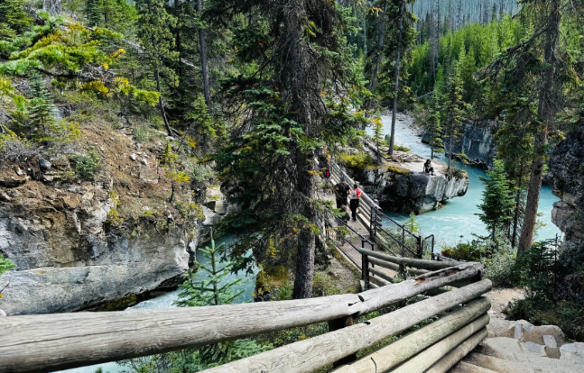
Marble Canyon Trail is a very short hike that somehow climbs to absurd heights above its length. The trail is just 0.9 kilometres long on one side, but it still qualifies as one of the must-stop places in the national park, because of how engineering of the trail allows visitors to have an unobstructed view of the canyon from multiple bridges. Interpretive panels help to slow down the pace of exploration, and red chairs from Parks Canada provide for a proper finish line. Close by, Paint Pots trail is a kilometre long on one side, but what it offers is quite unique – three mineral springs full of iron that stain the soil in beautiful hues of orange and rusty colors.
Stanley Glacier Trail is the hike that most accurately represents Kootenay’s balance of accessibility and grandeur. The trail covers 4.9 kilometres one way, with the difficulty rating as moderate and ends in an abrupt alpine basin with waterfalls from the glaciers cascading down from huge rock faces.
The long Kootenay lines worth the effort
Floe Lake is one of the strongest hard days in the park and one of the clearest examples of why Kootenay rewards persistence. The trail runs 10.8 kilometres one way with 1,120 metres of elevation gain, and Parks Canada calls it one of the most popular day hikes in the area. The reason is simple. The route climbs through sunny slopes and keeps opening bigger views before finally reaching a lakeside setting that feels properly earned.
For travellers who want something wilder and less obvious, Kindersley Pass and the Sinclair Creek line make a strong final step. Kindersley Pass stretches 10 kilometres one way and passes through forest and avalanche paths before revealing panoramic views near the pass and col. Sinclair Creek covers 6.2 kilometres one way and climbs through alpine meadows before opening onto similarly broad mountain country.
