
Calgary A View From Above: Roads, Rivers, Parks and Places!
Recently I was invited by Keith Walker of Peak Aerials to join him on a helicopter photo shoot over the city of Calgary, something he does almost weekly. For me, a unique opportunity to see how Calgary is evolving from a different perspective.
While I am not a professional photographer, I was able to get some decent shots of some of Calgary’s mega projects (Ring Road) and smaller ones (Flyover Park). It reminded me of the complexity of city building.
Link: City Building: Impact of Calgary’s Mega Transportation Projects
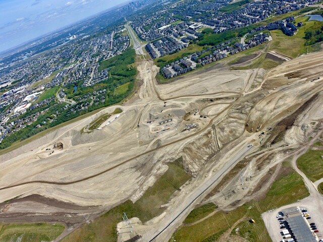
The West and South legs of the Ring Road are a massive undertaking. In some places, it looks like a huge open-pit mining operation.
From above, you can see how East Village (another mega project) is taking shape. But there are still a lot of surface parking lots waiting for redevelopment.

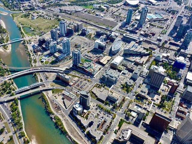
Zoom in and you get an interesting look at some of Calgary’s signature buildings - old and new. At the bottom in the middle is old City Hall with it distinctive red roof, to the left is the rectangular Bow Valley College building, the drift boat-shaped Central Library is the one with the speckled facade, just behind it with what looks like a spoon on the roof is the National Music Centre, the oval building is the new Platform Parkade, the huge triangular shaped, stepped building is the Municipal Building (perhaps it is time for a better name) and the turquoise colour building next to the green park (Olympic Plaza) is the historic Burns Building.

From above, you can see how the Greater Downtown is creeping eastward towards Stampede Park which will get a major billion dollar plus makeover over the next 10 years with BMO Centre expansion, new arena and Green Line LRT.
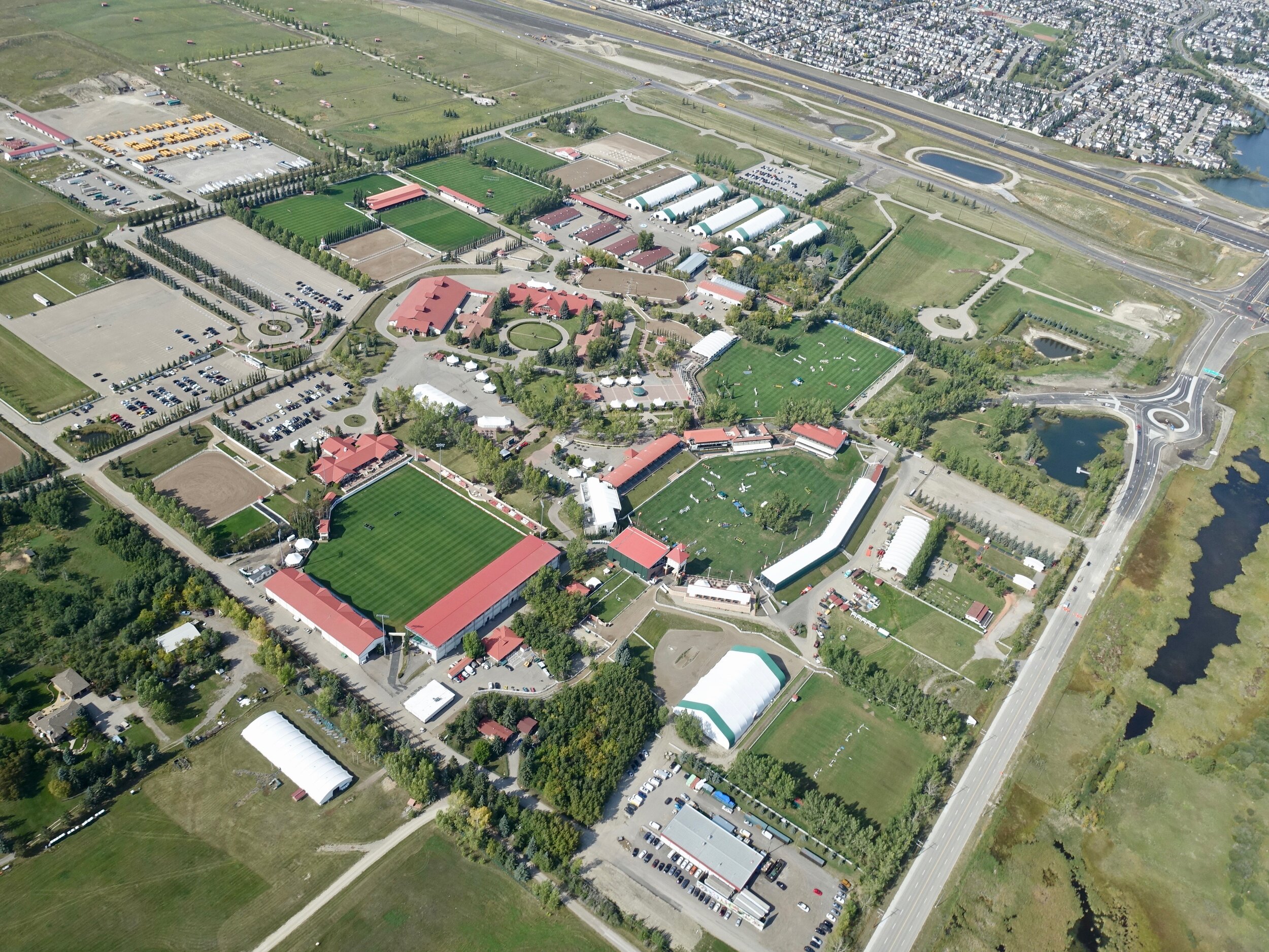
From above on the south side of City, you get to appreciate how the city has grown all the way to the Spruce Meadows Equestrian Centre. You also get to see how green Spruce Meadows is compared to Stampede Park.

From above, Canada Olympic Park looks snake-like.
From above, Signal Hill makes a dramatic statement. The hill features 16,000 stones hauled by soldiers and arranged to form four numbers - 137, 113, 151 and 51 - which represents the four battalions of the Canadian Expeditionary Force who trained in the area, before leaving to fight in World War 1.

The West leg of the Ring Road joins up with Highway #8, near the Pinebrook Golf Course is just beginning to take shape.

The West Ring Road at Old Banff Road / Springbank Road.

The Ring Road interchanges are just as confusing from the air as they are when you are driving on them. Could they make them more confusing? more expensive?
From above, the Westbrook LRT Station looks a bit like an arrow head. It is a shame the City hasn’t been able to develop the land around it to capitalize on the $1.4B investment and generated some much needed property tax revenue..
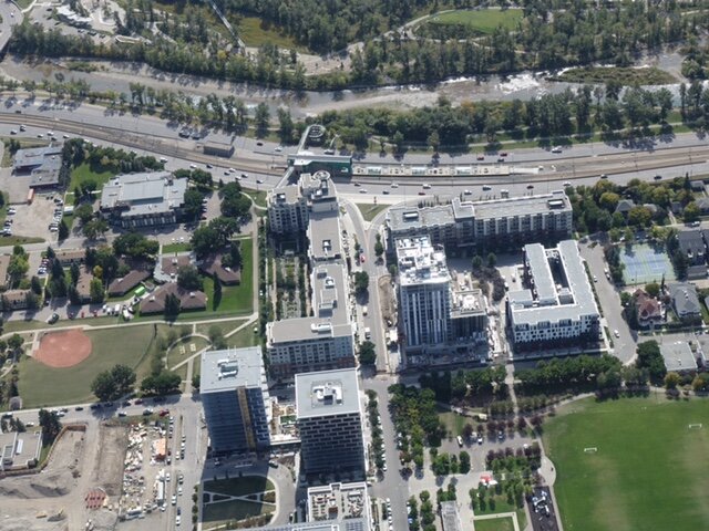
Fortunately Transit Oriented Development is happening next to the Bridgeland/Riverside LRT Station.

From above it is easy to see how dramatically different the density is between the southside (left) of the Bow River from the northside (right).

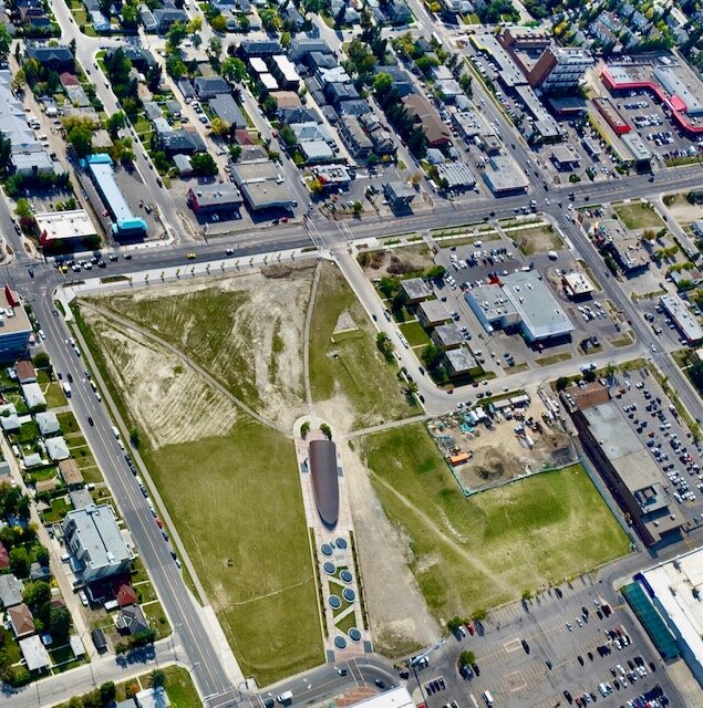
The east entrance to downtown is dominated by bridges, old and new, train and pedestrian. Flyover Park is visible with its small circular play areas (middle of photo), as is East Village’s RiverWalk.

Downtown’s Big Four - Brookfield Place, Suncor Energy Centre (formerly Petro-Canada Centre), The Bow and TELUS Sky - all over 50 stories high.

When you fly over downtown you realize just how many office towers there are crammed into just a few blocks.

That contrasts dramatically when you fly over the northeast quadrant of the city with its huge flat warehouses and surface lots for thousands of freight transport trucks.

You begin to realize Calgary is a huge warehouse distribution centre supported by its modern railway, airport and road infrastructure.

Flying over the airport was a bit of a surreal experience with planes below and above you. You realize one of the reasons Calgary’s footprint is so large is that our airport is within the city’s boundaries, unlike the City of Vancouver.

Lindsay Park with the turtle shell Repsol Sport Centre with the Elbow River looping around it is a green oasis in the City Centre. As are the two cemeteries just above it.
From above you get to appreciate Baker Park’s formal garden design.

Currie Barracks redevelopment is another of Calgary’s mega inner-city infill projects. You can see the increased density of Currie vs the middle and late 20th century neighbourhoods.

Arbour Lake is one of a dozen or so lake communities in Calgary. Fun Fact: Calgary’s Lake Bonavista was Canada’s first lake community.

On the northern edge of the City is the new Inland Athletic Park, which was created from Inland Aggregates’ old gravel pit. It has a fun sense of place with the four stylized stick figures of children playing different sports.

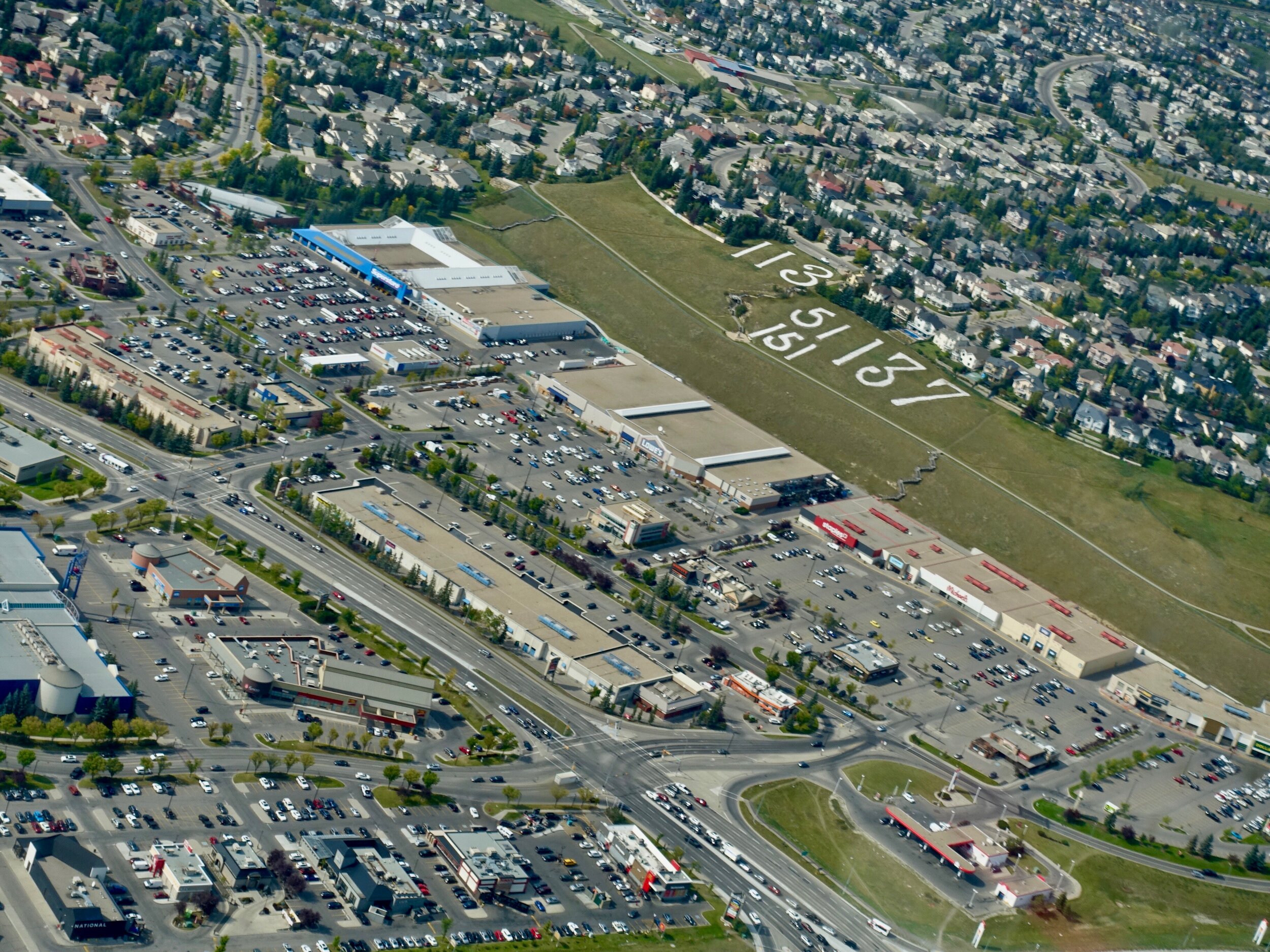
We also flew over the town of Cochrane, which gave me a better appreciation of how large a footprint the Spray Lake Sawmills takes up in the centre of town. It is reminder Calgary and area has a long history as a lumber mill centre. Also I was amazed at the footprint of the big box developments in the centre of town. You get a real appreciation for how much space is reserved for parking vs. actual retail space. The same is true for the housing development along the golf course.
Last Word
We all get to see Calgary from above when we fly from the Calgary International airport on vacation or business, but it is not the same as spending 90 minutes hovering over the city. You definitely get a better appreciation for how complex urban planning and city building is.

This is the new West Ring Road interchange being built at the Trans-Canada Highway. I have driven by this site 100+ times over the past two years and I am constantly amazed at the complexity of the design and marvel at how they can keep the traffic moving through the site. Let’s hope everything lines up at the end.