Road Trip: Postcards From Alberta's Badlands & Ghost Towns
This summer we decided to explore some of the off-the-beaten path places in southern Alberta. Our first adventure was to Drumheller (where we haven’t been for decades) and to some of the small town “main streets” along the way, as well as the Badlands.
This road trip strengthen our resolve to think outside the “city.”
Road Trip Tip: Sometimes on a road trip you find yourself with some downtime, looking for something to do. If so check out 1Win Canada.
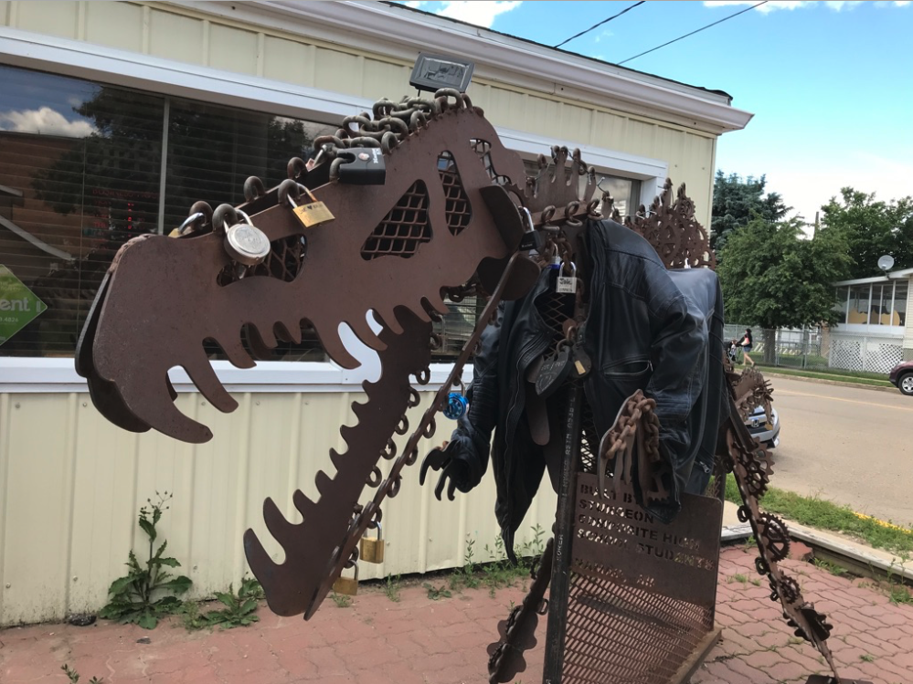
Public Art?
More public art?
HOPE….found this book sculpture at the Salvation Army in Drumheller.
Everybody loves a train ride!
First Stop: Irricana (population 1,216)
Its name is a contraction of the words “irrigation canals” which are found in the area. Settlement dates back to 1909 and it was incorporated as a village on June 9, 1911, by which time it had a post office, hotel and general store operated by the Irricana Trading Company. Today, though the store’s building is still standing, is abandoned and much of the Main Street consists of vacant lots making it look like a ghost-town. While there are some attempts to add some colour and charm with murals, it seems a bit futile.
However, just outside of town on the highway #9, sits a fun installation of farm equipment mounted high up on posts promoting, Pioneer Acres, where I am told you will find a dozen buildings filled with unique exhibits and artifacts from the early prairie pioneers. Too bad those buildings weren’t located in the town along Main Street.
Link:Pioneer Acres https://www.pioneeracres.ab.ca
The Irricana Hotel a reminder of the community’s once bustling Main Street. Today “Old Smoky” stands guard. The plaque says the horse was fabricated by Kevan Leycraft and donated by Melvin Brown to commemorate his residence in Irricana since 1952. He passed away in 1997.
Main Street Irricana.
One of several large paintings attached to the sides buildings in downtown Irricana to add some colour and charm. These were done by artists Leona Fraser in 2009.
Second Stop: Beiseker (population 819)
Lying in a belt of rich black soil, Beiseker was developed as an agricultural service centre. It was founded by the Calgary Colonization Company, whose purpose was to promote settlement by demonstrating the grain-growing potential of the area. The village is named after Thomas Beiseker, a partner and vice president of the company. The surrounding area became known as "World Wheat King Capital" because of its ability to grow wheat. Today, a small park at the end of main street tells the history of the town. It even has a tiny sod house that you can explore.
The village began to grow in 1910 when the branch line of the Canadian Pacific Railway was completed. The Grand Trunk Pacific line - now owned by Canadian National Railway - was constructed in 1912 to the east of the central business district
With the construction and intersection of Highways 9, 72 and 806 being at the northeast edge of the village, Beiseker came to have a very favourable location in terms of road and rail access. Almost equidistant from Calgary and Drumheller, Beiseker began to emerge as a local service and trade centre for the surrounding rural agricultural area.
Beiseker currently serves as a centre for local agricultural services including fertilizer, seed cleaning, and soil testing. There is a local UFA outlet, and a Canadian Malting Co. grain elevator serving farmers in the area. Local industries serve the oil patch.
It is also home to the Canadian office of Lampson International, a large international company specializing in construction cranes and a biomedical incinerator which handles medical waste from hospitals in Alberta, Canada and internationally.
Not unlike Irricana, wandering Beisker’s main street on a Saturday morning was akin to walking in a ghost town - nobody on the streets, lots of the main street buildings are gone and those that remain look like they are struggling to survive.
Old and new, train station becomes City offices.
It is hard to imagine that people actually lived year round in these tiny homes. Put the new “Tiny Homes” trend into perspective.
If you wander around the residential streets your will find these fun gnome fire hydrants. We have seen these before in small Alberta towns. Not sure if this is an Alberta thing, prairie thing or small towns everywhere. They sure are fun.
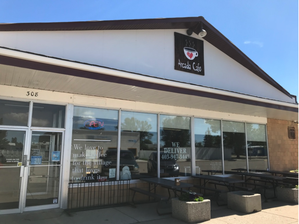
We decided to have a coffee and pastry at Arcada Cafe….great cinnamon buns…and we almost missed the fact they have a vintage arcade room in the back. A must see for anyone into old arcade games.
Love the graphics on the old games….
Love the fun factor…
Third Stop: Horseshoe Canyon Park
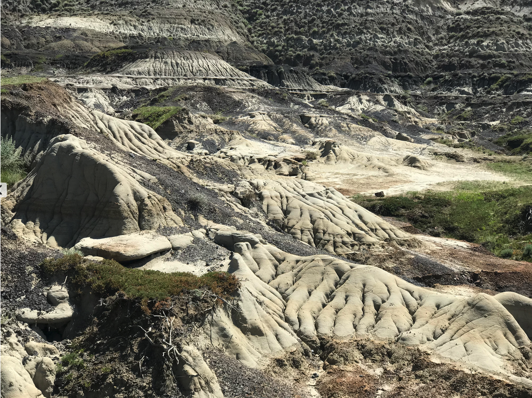
While not the Grand Canyon, Horseshoe Canyon sits just off Hwy 9, 17 km west of Drumheller in the Canadian Badlands. It is an eye-popping sight. Stand at the edge of this huge U-shaped canyon and try to imagine what it was like when the dinosaurs roamed a lush sub-tropical habitat some 70 million years ago. Today, marked trails guide your wandering down into the canyon to get a closer look at the different soils, rock formations and plants. There are even helicopter rides available on-site. The park is free and there is lots of free parking.
Horseshoe Canyon
Fourth Stop: Drumheller (population 7,982)
When we first moved to Alberta in the early ‘80s, Drumheller was best known as the home of the Drumheller Institution (aka prison). Opened in 1967 as a medium security facility, a minimum security facility was added in 1997. Today, it has a capacity of 704 (582 medium security and 122 minimum security). The Institution provides a stable economic and employment base for Drumheller and surrounding area.
In the late 1980s, Drumheller became famous as a center for dinosaur tourism and research with the opening of the Tyrell Museum in 1985 (it subsequently received “Royal” status in 1990. Located 6 km northwest from Drumheller, the museum is situated in the middle of the fossil-bearing strata of the Late Cretaceous Horseshoe Canyon Formationand holds 130,000 fossil specimens from the Alberta badlands, Dinosaur Provincial Park and the Devil's Coulee Dinosaur Egg Site. In the first year it attracted over 500,000 visitors from over 100 countries. Today, it averages about 350,000 visitors annually.
We opted to skip the museum (a new exhibition had just opened and it was a zoo) to flaneur downtown Drumheller. To our pleasant surprise, the downtown has several charming shops, restaurants - even a Saturday farmers’ market. What impressed us most is how the city has capitalized on the dinosaur theme with fun creatures at every downtown corner making for great photo ops. We encounter several families exploring the downtown taking photos of the kids with the dinosaurs.
Love these fun cartoonish characters waiting for you to sit beside them. Perhaps cities take their public art programs too seriously. People just want to have fun….perhaps big cities take their public art too seriously?
Downtown Drumheller has an eclectic collection of shops to explore.
Treasure hunters will enjoy Drumheller’s downtown art galleries and antique stores.
Couldn’t resist one more postcard of the fun benches. I preferred these to the World’s largest dinosaur (86 ft high and 151 feet long) that is located a few blocks from downtown.
There are dinosaurs everywhere you look in Dumheller.
Drumheller has preserved a sense of past in its downtown.
How clever? All of the streets have not only old names but new dinosaur names. How fun!
Just outside of Drumheller on the way to Wayne is Asterroid a must stop for those who like ice cream. No road trip is complete with out an ice cream cone.
Fifth Stop: Wayne (population 40)
Wayne, located 10 km southeast of Drumheller was once a thriving coal mining town whose population is estimated to have reached a high of 10,000 in 1932. The last mine closed in 1957 and today it is home to about 40 diehard souls. Half the fun of visiting Wayne is navigating a winding road with 11 (no word of a lie) one-lane bridges along a moon-like landscape to get there.
In its heyday, Wayne had a school, hospital, hotel, theatre and several stores along its main street. Today, all that remains is the Rosedeer Hotel which surprisingly still operates as a hotel and its Last Chance Saloon, now a popular watering hole for touring motorcycle groups. The hotel has only 6 rooms, each with a different theme – Titanic, Golf, Harley, Miners, Honeymoon and Music Room.
The Saloon often has live music and hosts the annual WayneStock music festival (this year’s festival is from August 30 to Sept 2, 2019). While we were there the Maybellines were playing the afternoon set – it was magical.
Sixth Stop: East Coulee (population 148)
We “passed” on stopping at the Hoodoos Park just east of Drumheller and proceeded directly to East Coulee and the Atlas Coal mine (a national historic site) site 16 km east of Drumheller. Once home to about 3,000 residents, its heyday was between 1920s and 1950s when, like Wayne, the coal mines were excavating hundreds of thousands of tons of coal. Today, the old school has been converted into a museum which also hosts an annual spring music festival “SpringFest.” Unfortunately we arrived just after 5 pm too late to get into the museum.
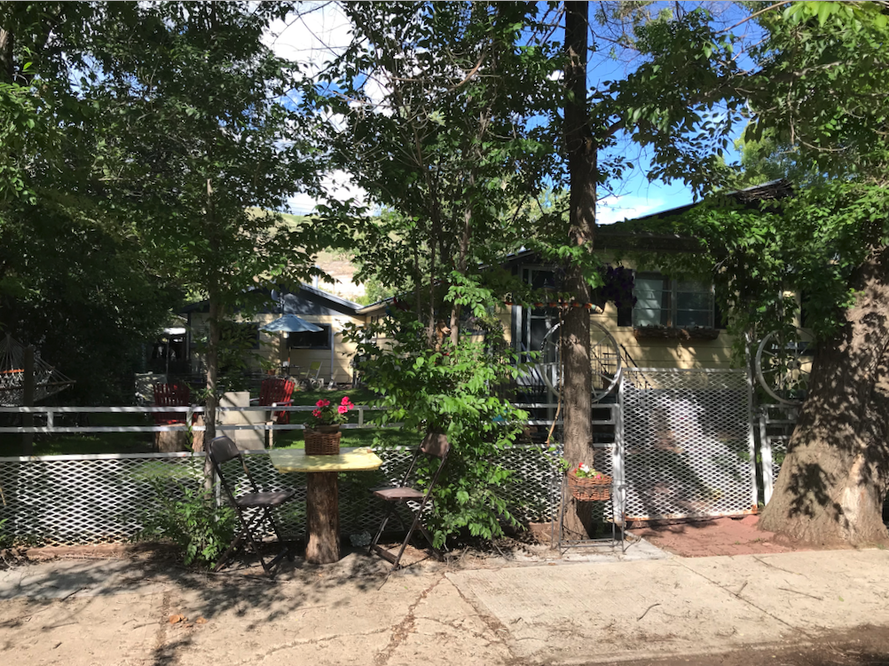
The streets of East Coulee are lined with huge trees, giving it an oasis-like feeling compared to the barren surrounding landscape. The tiny miners’ homes are a reminder of how early pioneers lived in modest small homes, each probably housed six or more people.
Nothing is left of its main street except one large building that has been converted into a studio for the manufacturing of dinosaur-related items for museums, movie studios, parades and theme parks. There is also a small gift shop with a lovely garden.
Just across the river from East Coulee is The Atlas Coal Mine National Historic Site that operated from 1936 to 1979. It is the most complete historic coal mine in Canada and is home to the country's last standing wooden coal tipple. In fact, it’s the largest still standing in North America. Designated a Provincial Historic Resource in 1989, it achieved National Historic Site of Canada status in 2002.
Various guided tour options exist. You can take a train ride through the site, walk up the tipple or tour the 210 foot underground conveyor tunnel. The facilities are open to visitors from May to Thanksgiving weekend.
With not enough time to do a tour (we arrived 20 minutes before closing) we instead walked up the dead end road west of the parking lot where we had heard there was an art installation. Sure enough, at the end of the road, stood dozens of five foot tall tree limbs with alien head-like nobs stuck in the ground with rock piles at their base to help them stay standing. Many of the limbs had various small trinkets hanging or sitting on them, creating a somber, graveyard sense of place. There is no markings or signs indicating who did them, why there are there, which only adds to the mystique.
You can hardly see the homes for the trees and shrubs in East Coulee. It is like time has passed this community by.
We were shocked to find a gift shop in East Coulee.
All aboard….
Railway bridge from Atlas Coal mine to East Coulee and beyond.
Atlas Coal mine site
There is lots of mine artifacts next to the parking lot with information panels.
Loved this coal dust sand box….
Public Art?
Seventh Stop: Rosebud (population 87)
It was founded in the 1885 by James Wishart, while following the Gleichen Trail with his family on their way to Montana. Arriving in the dark, they awoke the next morning to discover the river valley covered by wild roses- Alberta’s official flower. Wishart then reportedly said, "Here's the promised land; we go no further."
The beauty of the valley has attracted many people throughout the years, from nature lovers to artists. Notable Canadian artists A. Y. Jackson and H. G. Glyde, members of the Group of Seven, spent the summer of 1944 painting in the area.
Over the years, farming and coal mining have been the primary industries. In 1972, the Severn Creek School was shut down as part of an Alberta-wide education consolidating process, forcing local children to be bussed to Standard and Drumheller. This resulted in the closure of many local businesses and the hamlet population dropping to under a dozen people.
But at Easter 1973, a group of young adults from Calgary brought about 40 teenagers out and camped in the then empty mercantile building. This pilot event initially evolved into a summer camp funded by a grant from the Alberta government and then later, Rosebud Camp of the Arts supported by Crescent Heights Baptist Church in Calgary.
In 1977, a high school was founded using the old buildings of the town as classrooms and emphasizing practical visual, music and the performing arts in its curriculum. In the 1980s, Rosebud School of the Arts began to operate theatre, which eventually developed into Rosebud Theatre and the school shifted its emphasis to post-secondary education.
Today, Rosebud Theatre runs as a fully professional company that offers programming year round and is a tourist attraction drawing patrons largely from Calgary and Drumheller. It has a few shops, an art gallery and an excellent museum along its two main streets. There were probably a dozen people wandering the streets while we were there. There are even an inn and bed & breakfast accommodations for those not wanting to drive home after the theatre.
While tourism might save Rosebud, it can’t save every small town and village in Alberta.
Link: Rosebud Theatre
Link: The Hamlet of Rosebud
The old hotel is now the offices for the Rosebud Theatre.
The Rosebud Museum/Library has an extensive collection of early 20th century artifacts documenting the life of the early prairie settlers. Admission is FREE.
In the Library…the tag reads “Tailored by Suzanne est. 1952. Dress donated by Minnie Neufeld (Ziegler). Worn during the time Minnie waitressed for the Carolina a well-known restaurant in downtown Calgary. Off duty standards for dress and behaviour were very strict. No gum chewing, spitting or swearing in public.
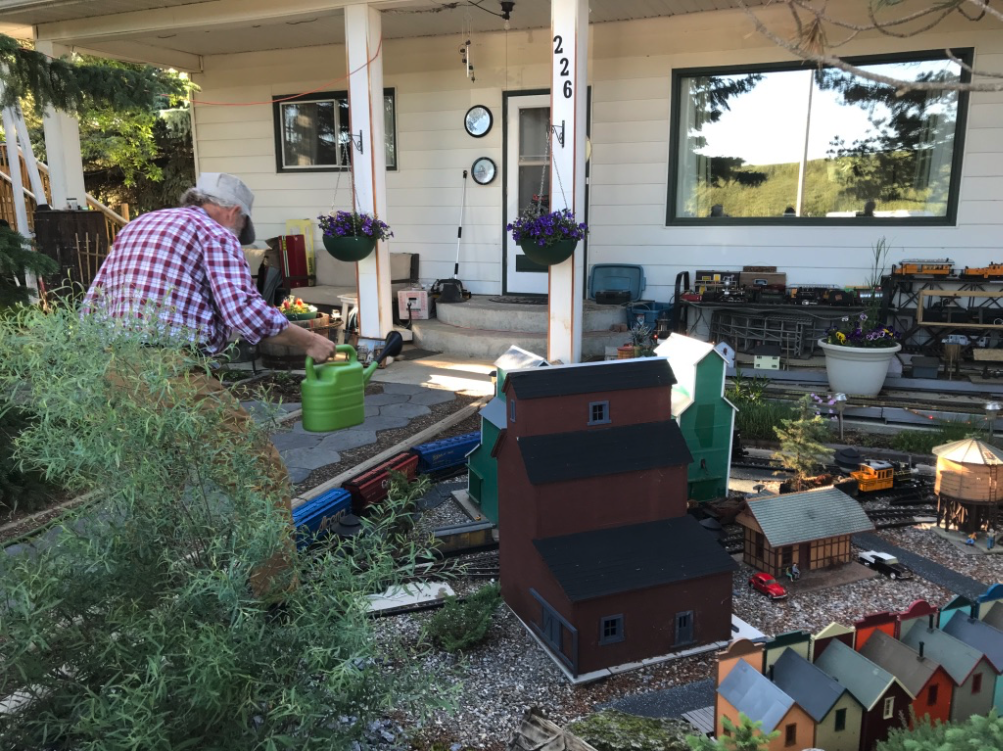
While wandering the streets we found this house with an elaborate model railway in the front yard. The house next door was in the process of being remodelled to sell model railway pieces.
Lesson Learned
On our way home, we chatted about how this road trip was a good reminder of how Alberta and the prairies have evolved over thousands of years from roaming dinosaurs, to nomadic indigenous people, to agricultural and resource pioneers (first coal, then oil and gas), to today’s corporate farming and resource development.
It is good for us city folks to get out and explore the real towns and villages (not just the tourist attractions and tourist towns - aka Banff and Canmore) to get a better perspective of the world we share. While much of the media attention these days is about the urbanization of Canada and decline of rural living, there are still a significant number of people living in rural Alberta communities - 656,048 according to 2016 Census of Canada.


